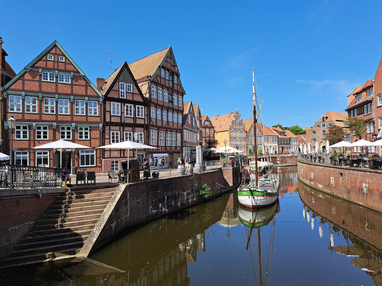
The old Hanseatic harbour is not a museum but a piece of the town that has lain in the same place for a thousand years. From its quay walls flat-bottomed Ewer barges were once loaded and unloaded, goods weighed and duties paid. Today the guests of the cafés sit along those same walls — and all of it very nearly became a car park.
A landing place becomes a harbour
Before there was a harbour there was a landing place. Boats were drawn up on the natural bank of the Schwinge, near the point where the river still feels the tides of the Elbe. Around the year 1000 — shortly after the Viking raid that first brought Stade into the chronicles — this landing place was built up into a proper harbour basin. Until the 13th century that made Stade the most important natural harbour between Cuxhaven and Harburg.
Around 1300 the basin was shifted, enlarged and given quay walls along the sides. Since then the harbour has lain in its present place and has almost exactly the shape you see today. An extensive excavation by the town’s archaeologists has traced that story in the ground in recent years — with finds from 1000 to 2014. So that ships could reach the town at all, the Schwinge was deepened several times from the 15th century onwards.
Two banks, two periods
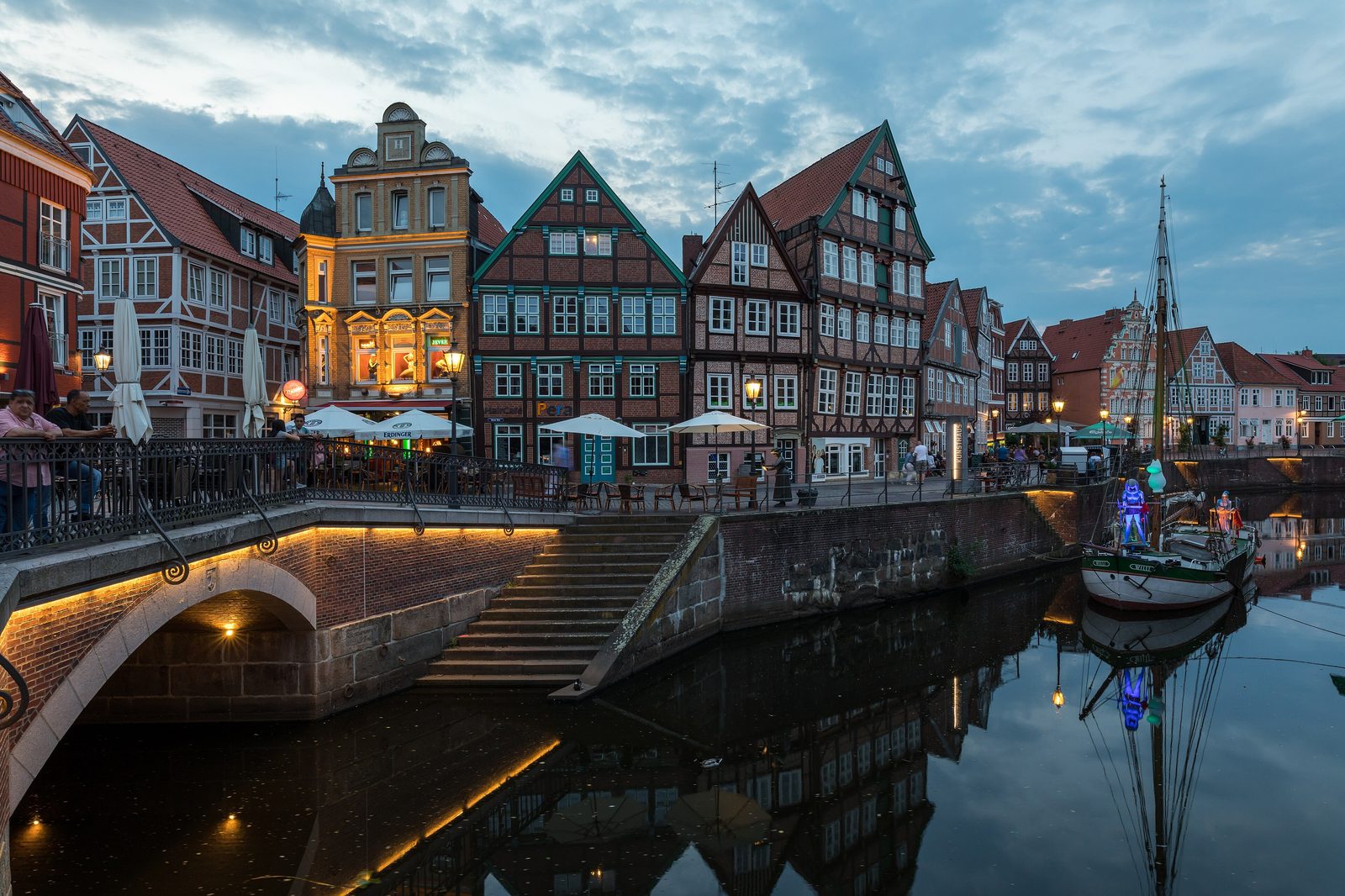
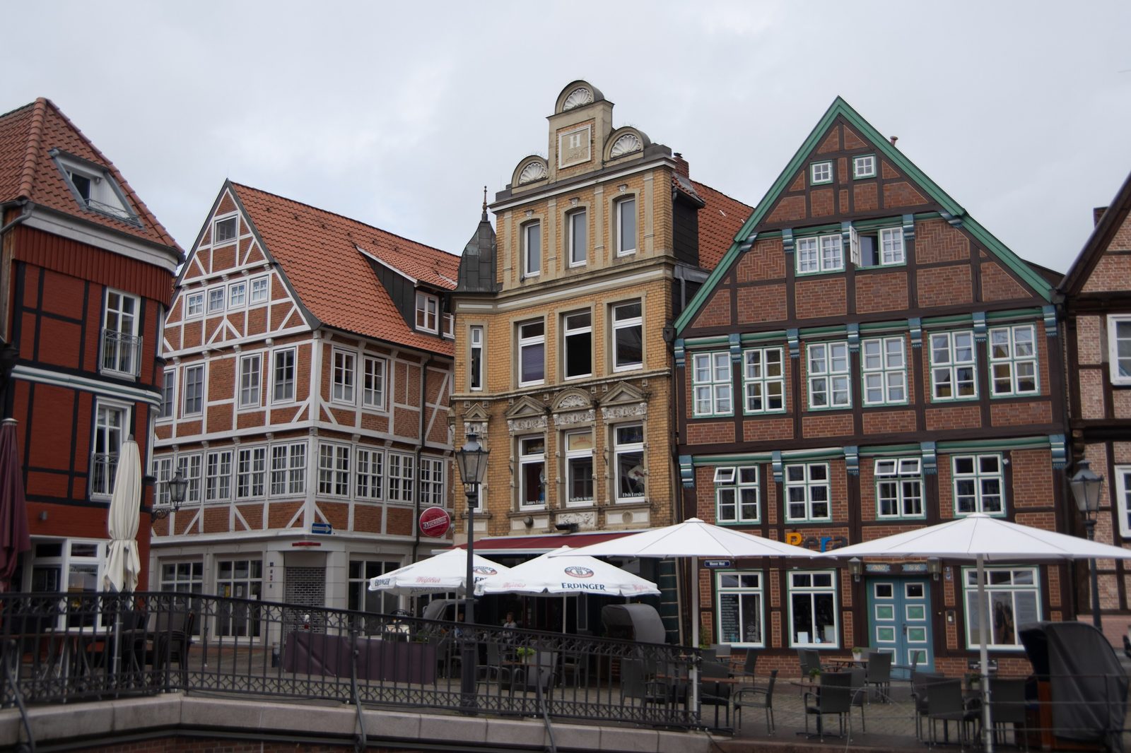
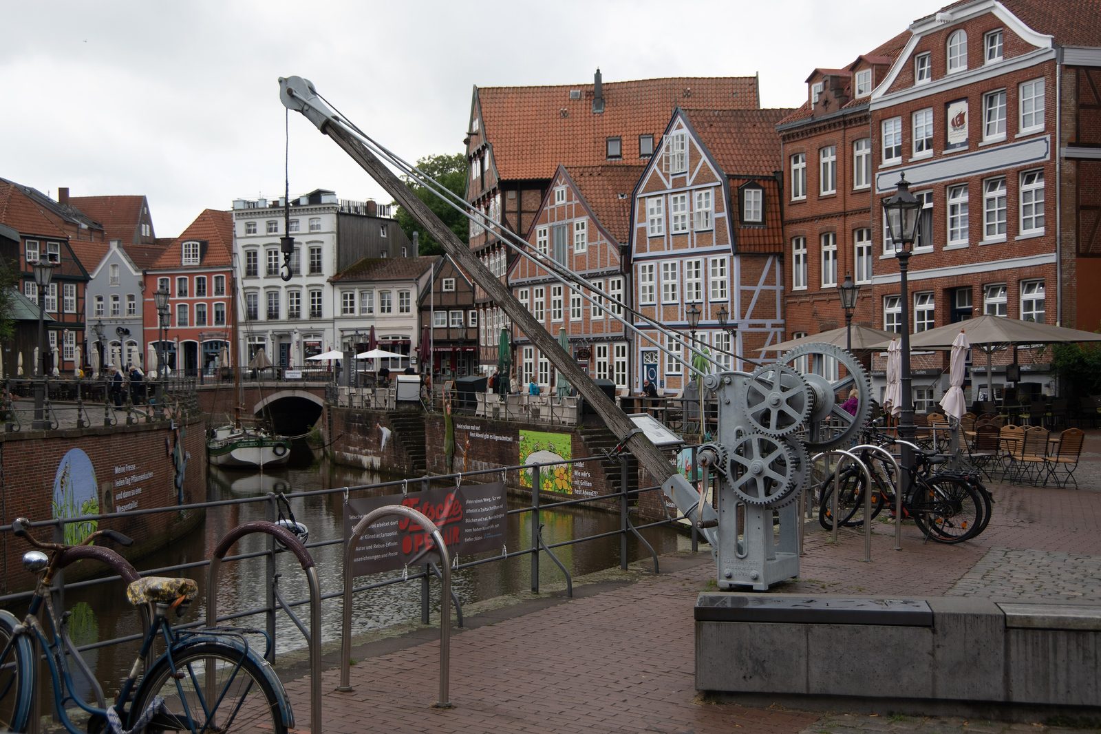
The harbour is a long rectangle, lined on both sides by streets of half-timbered houses. The houses on Wasser West reach back to the 15th century. The row on Wasser Ost is younger, since its original buildings fell victim to the town fire of 1659. Comparing the two sides means reading two chapters of the town’s history.
To the south-west, at the Fischmarkt, the Hude bridge closes off the harbour — a brick bridge with a barrel vault, thoroughly renewed in 2014/15 for around two million euros. At the other end, to the north-east, the Schwinge sluice has stood since 1792, right beside the Swedish warehouse completed in 1705, the former provisions store of the Swedish garrison.
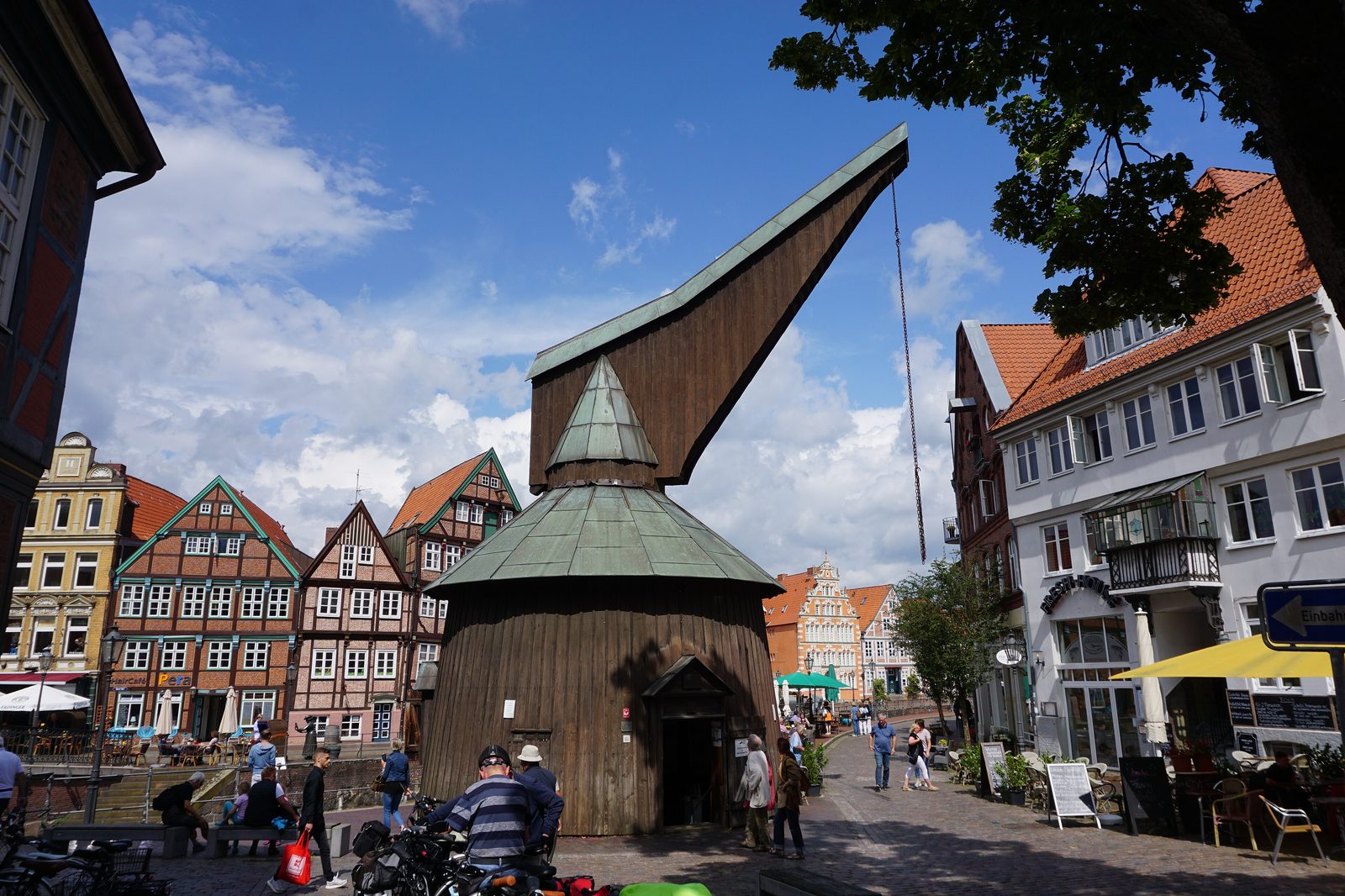
The crane at the Fischmarkt
The most striking structure at the harbour is the wooden treadwheel crane on the south-west side. It is a reconstruction from 1977, built on the model of the old crane in Lüneburg and erected on the former site of Stade’s salt crane of 1661. The replica shows the outward form but not the mechanism within. The dilapidated original had been demolished in 1898; before that it had served to load and unload the Ewer, those flat cargo sailers that governed traffic on the Elbe and the Schwinge for centuries.
A second, younger crane stands at the town harbour: the electric harbour crane of 1927 from the Bamag-Meguin works in Berlin, originally mobile and today a listed monument. First secured in 1986, repaired at the counterweight in 1999 and faithfully restored from spring 2007 to June 2008, it recalls the time when Stade still had cargo shipping in the town.
Weighed and taxed: the town weighhouse
Part of the harbour was the town weighhouse of 1753, a half-timbered building that served as a customs house into the 19th century. In the mid-1970s it was to be demolished. Today it has been restored and is used as a home and business premises — an example of how narrowly some things at the harbour escaped disappearing.
1962: the flood and the end of shipping
For more than a thousand years the Hanseatic harbour was a tidal harbour, connected through the lower Schwinge with the Elbe and its tides. That changed after the great storm surge of February 1962, which put the northern old town under water. As a consequence the harbour was separated from the tidal water in 1968 by a weir with a road running over it. Since then it has not been navigable. What it lost in function it gained in calm: the water stands still, the façades are reflected in it and the harbour has become a magnet for visitors.
Almost a car park
That this happened at all was by no means a matter of course. In the mid-1970s the town council seriously considered filling in the thousand-year-old Hanseatic harbour and laying out a car park in its place. At the same time the town weighhouse was up for demolition. It turned out otherwise: the harbour and its historic fabric survived, the Swedish warehouse was restored from 1975 and opened as a museum in 1977, and the treadwheel crane was built the same year. The decade in which the harbour nearly vanished became the decade of its rediscovery.
Today the historic quays are used above all by cafés and restaurants, especially in the summer half of the year. The harbour is also one of several on the Schwinge — but only this one lies where you can drink a coffee at its edge, on the spot where merchants unloaded their goods seven hundred years ago. More about the buildings around the basin can be found under Sights.
Gallery